Akron Metropolitan Area Transportation Study
The July-December 2019 issue of @AMATS is now available. This issue contains features about the 2019 Active Transportation Plan, our October Annual Meeting, and a re-cap of…
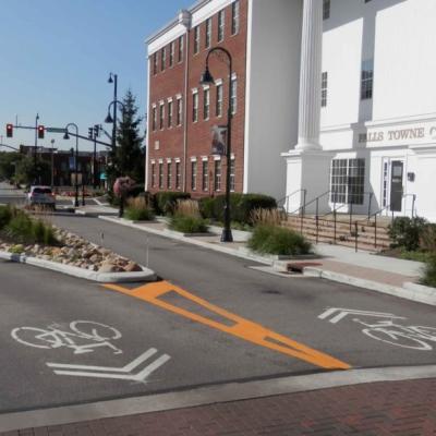
The new 2019 Active Transportation Plan (ATP) prepared by AMATS presents the various strategies and recommendations that the Greater Akron area will pursue to improve the…
Applications are now available for AMATS fifth round of Connecting Communities Planning Grants. AMATS has made available $80,000 for two $40,000 planning grants with the…
The Akron Metropolitan Area Transportation Study developed the Connecting Communities Initiative to encourage the integration of land use and transportation. The purpose of…
Our agency is pleased to launch AMATS Transportation Talk, a new podcast series that focuses on transportation happenings within the Greater Akron area. Transportation…